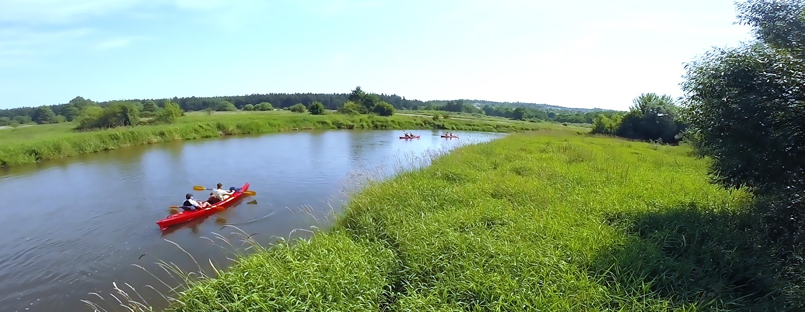
Nida
Nida is a 151 kilometers long left-bank tributary of the Vistula River. It is located in the middle part of Southern Poland, in Świętokrzyskie Voivodeship, between Cracow and Warsaw. Maximum depth is rarely more than 1 meter. Nida is a typically flat water river with rather indolent flow. It meanders strongly from time to time, creates small islands, coves, oxbows. It flows among hills, woods, meadows and fields. The valley of Nida River is a paradise for many rare plants and animals preserved in landscape parks, nature reserves and Natura 2000 zone. Nida is created by two source – rivers: Biała Nida and Czarna Nida. Both of them are perfect for touring kayaking. Nida is a spine of Ponidzie – the area which is attractive because of its nature as well as history.
.
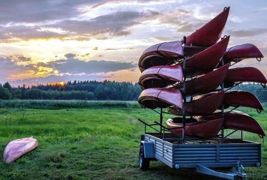
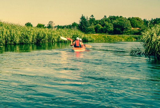
The kayaking route on Nida River
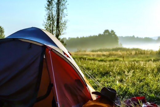
On the kayaking route there are very few obstacles: a few bars, small rapids, ruins of old water-mills, fallen tree trunks. Overpassing them is quite easy and makes the trip more interesting. In some sectors, especially during very hot summers, grindings and shoals may occure. Only in few places you have to carry the kayaks over by land. The kayaking route on Nida River is not burdensome, easy and very picturesque. Warm and clear water and sandy bottom are perfect for swimming. Charming nooks invite to camping. One of the greatest advantage of Ponidzie is a small number of kayakers which guarantees privacy.
The distance
| 121,5 km START | Mniszek on Biała Nida, a bridge – route no. 728 Jędrzejów – Małogoszcz, kayaking trips start before the bridge, the cars may be left on a farm in a water-mill (l), the nearest grocery shop is in Lipnica, 2 km towards Małogoszcz. |
|---|---|
| 121,0 km | (r) Kajakiem.pl’s camp-site in a small pine wood |
| 119,5 km | (l) the estuary of Lipnica River |
| 117,0 km | (l) an old, wooden water-mill on an island, a footbridge (depending om the water level it might be necessary to drift the boats underneath |
| 115,0 km | (r) the river gets closer to a road, a convenient spot for a break, a grocery shop in a nearby village Bizorenda |
| 114,8 km | a concrete bridge, the river starts to meander strongly |
| 109,0 km | (l) the estuary of Wierna Rzeka |
| 108,0 km | a small bar, 200 m of a stone grinding, (l) Kajakiem.pl’s camp-site |
| 106,5 km | Chojny Village, a road bridge, behind it (r) ruins of a water-mill, a passable right arm with a strong current a a small rapid |
| 103,0 km | a metal footbridge, a wide ford, a pretty view on Chęciny castle’s ruins, (r) Żerniki village, a convenient spot for ending a one-day trip |
| 102,7 km | (l) the estuary of Czarna Nida River – further you go on Nida River kayaking route |
| 140,5 km START | (l) Suków Papiernia, the begining of the kayaking route on Lubrzanka, one of the sources rivers of the Czarna Nida River |
|---|---|
| 137,5 | Marzysz, Lubrzanka and Belnianka joining, the begining of Czarna Nida |
| 136,4 km | (l) Marzysz Młyny, a portaging before the bridge, paddle the right arm |
| 134,0 km | (r) Kuby Młyny- a portaging, paddle the left arm |
| 128,4 km | (r) Bieleckie Młyny- a portaging to the left arm |
| 127,5 km | (l) Morawica on Czarną Nidą , a portaging to the right arm, a bridge on Kielce-Chmielnik route, a convenient spot for launching off under the bridge |
| 123,5 km | a railway bridge |
| 120,0 km | (r) Nida village, a footbridge |
| 117,5 km | (r) Kajakiem.pl’s camp site |
| 117,3 km | a bridge (r) Ostrów village, a grocery shop and Ptasi Azyl- Wild Animals Rescue Centre |
| 114,5 km | a railway bridge, behind it a mill-race, paddle left |
| 112,5 km | (l) a mill in Wolicy, a portaging on the right bank, behind the mill a few rapids |
| 108,0 km | a bridge on thr route no. 7 from Kielce to Kraków- during dry summer floating the boats is necessary |
| 106,0 km | (l) a hill Tokarnia with a Heritage Park - Muzeum Wsi Kieleckiej |
| 102,7 km | Biała and Czarna Nidy joining, further you go on Nida River kayaking route |
| 102,0 km | a bridge on route no. 7, piles under the bridge, 400m behind it (l) Kajakiem.pl’s camp site |
|---|---|
| 98,0 km | a railway bridge, paddle left, (r) Brzeźno village- a grocery shop, 200m further, (r) Kajakiem.pl’s camp site |
| 97,5 km | (l) the castle in Sobków- a hotel, a restaurant, a stud farm. A good place for lunch or coffee. |
| 93,0 km | a bridge, (r) Mokrsko village- a grocery shop, ruins of a renaissance residence, next the river flows through the woods. In the village there is a grocery shop, on the right bank, about 200m from the bridge. |
| 88,0 km | (l) Stare Kotlice village, a good place to finish the trip |
| 82,5 km | Rębów- a dam with a hydroelectric power station, a portaging on the left bank |
| 80,5 km | a concreto bar, a portaging necessary |
| 80,0 km | a bridge, a small rapid, piles, (r) Motkowice village – a grocery shop |
| 79,0 km | a railway bridge |
| 77,0 km | a samll railway bridge, 500m further a small bridge |
| 74,5 km | a dangerous rapid, 100m further a bar with a strong towback. Attention! Both obstacles must be carried over on the bank. |
| 71,5 km | a bridge, (r) Sobowice, a few small bars ahead – no portagings needed |
| 67,0 km | (r) estuary of Mierzawa River |
| 64,0 km | a bridge next to flying club, (l) Pińczów |
| 57,0 km | (r) Kowala village, a rope dangling from one bank to another |
| 51,0 km | (l) Krzyżanowice, a holiday resort another rope dangling from one bank to another |
| 46,0 km | a bridge, piles underneath, (r) Chroberz village- a grocery shop, before the bridge (r) a camp site, behind the bridge (r) agroturism farm – possible accommodation |
| 41,5 km | (r) Nieprowice, a bridge |
| 30,0 km | (r) Jurków, possible camping spot by the ford, a grocery shop in the village |
| 26,0 km | a bridge on the route from Wiślica to Koniecmosty, a few hundret metres further (l) a camp site near sights in Wiślica |
| 15,0 km | (r) Czarkowy- a bridge |
| 13,5 km | (r) Żukowice- a bridge |
| 10,0 km | (r) Stary Korczyn, a bridge |
| 5,0 km | (l) Nowy Korczyn, Attention – piles!!! |
| 0,0 km | Nida estuary, further you paddle on the Vistula River |